Through digital mapping technologies, it is becoming easier for all manner of people to influence urban development efforts. This fact may be of particular significance to disabled communities, for whom urban environments are all-too-frequently inaccessible.
Economic development in the U.S. has long depended on the GIS professional industry, even more so with the rise of smartphones. Companies and investors looking to target a particular geographic region place a high premium on personal location data–where city-dwellers shop, how often and where they drive, what transit systems they use, whom they go with, and so on.
Increasingly, the answers to such queries are influenced by our growing dependence on cheap, accessible mapping applications (e.g., Google Maps) for everyday navigation and wayfinding. While these technologies make traveling more efficient, they may erode reliance on mental mapping and more “traditional” wayfinding tactics, with consequences for how we perceive, conceive of, and “live” public space (Reynolds, 2004; Rice, 2012). Even if we aren’t using Maps to get where we want to go, many of the most popular smartphone applications in 2016–Facebook, Instagram, Snapchat, Yelp–integrate maps or location-based services (LBS) to some degree. This means that features of the apps (including ads) morph according to one’s location, tethering data more and more to spatial orientation and the material environment.

While some commentators are less than sanguine about these developments, location-based services and digital mapping platforms undoubtedly make cities more accessible for many people–particularly when the technologies in question are accessibly designed. Both Google and Apple Maps have been praised by visually impaired users for their voice command features, for instance.
What I am most interested in discussing here, however, is not the accessibility of the technologies themselves, but in how these technologies present disabled users and activists with opportunities to influence economic development via community mapping. Scholars in disability geography have long studied how physical environments reflect, produce, and enact disability discrimination (Chouinard, Hall, & Wilton, 2010; Gleeson, 2013). Increasingly, these folks and others generally invested in social change are using participatory mapping (frequently referred to as ‘participatory GIS’) as a method to democratically engage local community members in planning efforts (see Evans, 2009; Fahy & Cinneide, 2009; Koti, 2010; Sletto, 2009).
The networked nature of digital mapping today, as well as the easy reproducibility of digital maps, marks a dramatic shift in the possibilities for such projects. Put simply, non-expert activists need no longer depend on geographers to access and design persuasive, scientifically accurate maps. For rhetoricians, this raises important–and complicated–ethical issues, specifically concerning geo-literacy and dataveillance.
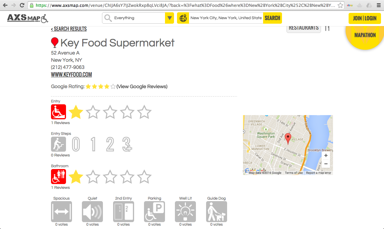
A number of community mapping projects have emerged to counter accessibility fails in the built environment. One prominent example, AXS Map, poaches on the Google Maps Application Programming Interface (API) to allow users to rate an establishment’s accessibility (or lack thereof), leave written comments, and share information quickly and directly with other users. Such projects dovetail nicely with text-based social media initiatives such as ‘Is This Venue Accessible?’, an online space where people can write about accessibility fails at popular entertainment venues.

Community mapping for accessibility may be of considerable interest to digital rhetoric and composition. First, projects like AXS offer teachers and scholars opportunities to explore mapping as a critical mode of resistance to ableist spacemaking regimes (e.g., community development activities and building projects that ignore embodied diversity). Second, for those interested in service learning, community literacy, and public writing, projects such as AXS provide a model for reckoning with “geographies of difference” in our communities, as well as chances for students to develop essential geo-literacies and participate in collective community action.
Potential benefits aside, mapping for accessibility presents complicated problems of authorship, audiences, ecologies, and circulation that practitioners should attend to. I want to focus on two problems in particular:
- Interface problems: As J.B. Harley and Paul Laxton (2001) argue in The New Nature of Maps, maps naturalize the landscapes they depict by virtue of their scientific bonafides. They emerge from discourse, reflecting the interests of the governments, militaries, academics, and corporations that design them and legitimate their use: thus, they tend to display businesses, universities, and major public buildings, leaving marginalized spaces and places out. Unless customized, most “default” maps do not show areas where people of color feel unsafe, or where women have been harassed. There is thus a danger in relying too much on the accuracy of cartography–it invisibilizes far more than it reveals. Community mapping projects must adopt this rhetorical perspective to be truly effective.
In particular, if maps are relied upon uncritically, projects like AXS could potentially miss moments when efforts to improve the accessibility of a material space clash with the needs and desires of other marginalized groups. It is well known that improving the accessibility of public areas or replacing outdated facilities with more accessible ones in new locations often occurs in tandem with gentrification, frequently placing communities of color at risk (indeed, more research is needed on the rhetorical relationship between disability access and gentrification). Intersectional disability studies frameworks such as Universal Design and Aimi Hamraei’s (2013) more recent “collective access” model–which incorporates social sustainability and environmental justice into participatory planning–may provide ways for community mapping initiatives to grapple with these complicated dynamics.
- User data problems: Secondly, in addition to the limitations of maps themselves, mapmakers should also be mindful of data sharing as an additional rhetorical dimension of technologies like Google Maps and LBS. Google Maps generates metadata that is in turn sold to advertisers. In addition, government agencies have been known to monitor Maps for surveillance purposes. In this way, maps and mobile phones sediment our movements with new layers of rhetorical meaning.
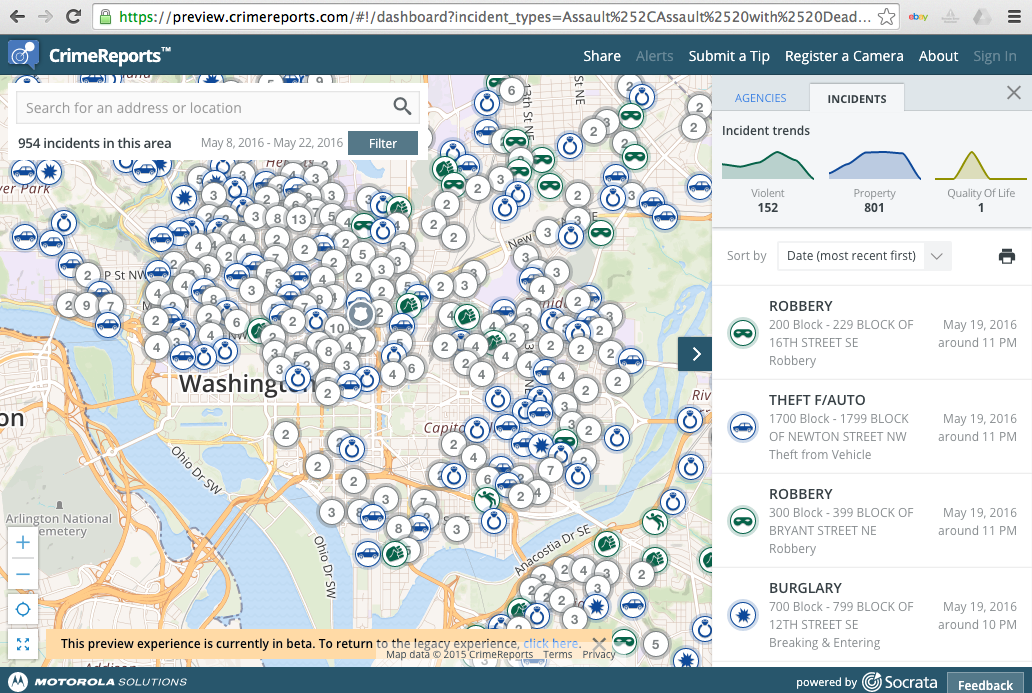
Once again, this would suggest potential for anti-ableist, anti-racist movements relying increasingly on mobile tech, but it also suggests significant dangers. In April 2015, for instance, the Department of Homeland Security reportedly used Google Maps to gather intelligence on a peaceful #BlackLivesMatter protest in Washington, D.C. (Choudhury, 2015). This incident demonstrates the complexity, and obliqueness, of geodata distribution via consumer digital mapping. Frameworks like Jenny Edbauer Rice’s (2005) “viral ecologies,” or Laurie Gries’s (2013) methodological toolkit for “iconographic tracking,” might inform efforts in writing studies to theorize how maps and location data get taken up across contexts. In any case, Maps users should explore data sharing as a rhetorical dimension of mapping for accessibility.

Given these caveats and the affordances and constraints of new mapping technologies, how do we begin theorizing mapmaking as anti-ableist, anti-racist resistance? What new uses can we find for mapping in our scholarship and our classrooms?
Works Cited
Choudhury, N. (August 04, 2015). The government is watching #BlackLivesMatter, and it’s not okay. ACLU Speak Freely Blog. Retrieved from https://www.aclu.org/blog/speak-freely/government-watching-blacklivesmatter-and-its-not-okay
Chouinard, V., Hall, E., & Wilton, R. (2010). Towards enabling geographies: “Disabled” bodies and minds in society and space. Farnham. Surrey: Ashgate.
Fahy, F., & Cinnéide, M. Ó. (2009). Re‐constructing the urban landscape through community mapping: an attractive prospect for sustainability?. Area, 41(2), 167-175.
Edbauer, J. (October 01, 2005). Unframing models of public distribution: From rhetorical situation to rhetorical ecologies. Rhetoric Society Quarterly, 35, 4. 4-24.
Evans, G. (2009). Accessibility, urban design and the whole journey environment. Built Environment (1978-), 366-385.
Gleeson, B. (2013). Lost and found in space. In W. Appett & K. Arndt (Eds.), Foundations of disability studies.
Gries, L. E. (2013). Iconographic tracking: A digital research method for visual rhetoric and circulation studies. Computers and Composition, 30(4), 332-348.
Harley, J. B., & Laxton, P. (2001). The new nature of maps: Essays in the history of cartography. Baltimore, Md: Johns Hopkins University Press.
Hamraie, A. (October 03, 2013). Designing collective access: A feminist disability theory of universal design. Disability Studies Quarterly, 33, 4.
Koti, F. T. (2010). Confronting sociospatial exclusion on the fringe of Africa’s cities using participatory GIS: Lessons from Athi River Town, Kenya. Africa Today, 56(3), 62-82.
Reynolds, N. (2004). Geographies of writing: Inhabiting places and encountering difference. Carbondale: Southern Illinois University Press.
Rice, J. (2012). Digital Detroit: Rhetoric and space in the age of the network. Carbondale: Southern Illinois University Press.
Sletto, B. I. (2009). We drew what we imagined. Current anthropology, 50(4), 443-476.
